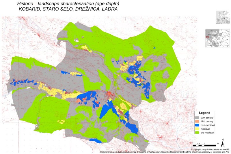
Historic Landscape Characterisation: Kobarid, Staro Selo, Drežnica, Ladra.
DESCRIPTION OF THE CATEGORIES
Map 3: Historical Landscape Characterisation (Age Depth, 1828)
© Benjamin Štular
Institute of Archaeology, Scientific Research Centre of the Slovenian Academy of Sciences and Arts
- 20th century: Landscape character predominantly caused by 20th century human impact as documented on succession of maps and / or historic records.
- 19th century:: Landscape character predominantly caused by 19th century human impact as documented on succession of maps (Franciscan Cadastre) and / or historic records.
- Post-medieval:: Landscape character predominantly caused by post-medieval human impact. Landscape-wide (micro-regional or regional) this impacts are rarely documented archaeologically, on succession of maps or in historic records. It can be indirectly dated through certain HLC (relict landscape) categories. Typically assarted fields are dated in late-medieval/early post-medieval period.
- Medieval: Landscape character predominantly caused by medieval human impact. Landscape-wide (micro-regional or regional) this impacts are rarely documented archaeologically or in historic records. It can be indirectly dated through certain HLC (relict landscape) categories. Typically fields in strips are dated in high-medieval period.
- Pre-medieval:: Landscape character predominantly caused by pre-medieval human impact. Landscape-wide (micro-regional or regional) this impacts are rarely documented archaeologically or in historic records. It can be indirectly dated through certain HLC (relict landscape) categories. Typically fields classified as "other" in the vicinity of archaeologically documented settlements are dated in pre-medieval period.

Download << Map 3 (zip) or open Map 3 (pdf).
<< Map 2 | >> Description of the Categories
Maps | Introduction | Top

