|
Programme - Late Antiquity
TONOVCOV GRAD NEAR KOBARID
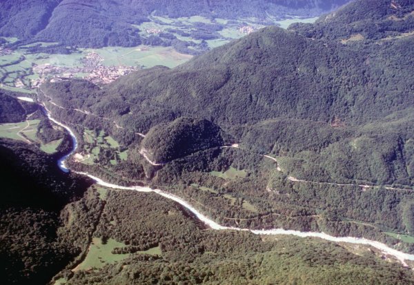
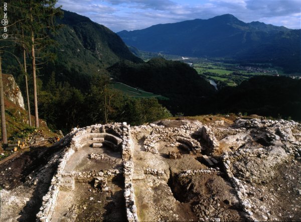
A view of Tonovcov grad.
General information
The fortified settlement of Tonovcov grad represents, with its architecture,
excellent state of preservation and material evidence, one of the largest and
most important Late Antique settlements in the south-eastern Alps.
The favourable position upon the hill encouraged people to settle here
through various historical periods. Stone weapons and tools were found in the
prehistoric layers, thus establishing the first settling in the long time-span
between the Neolithic period and the Bronze Age; while some finds are also
attributed to the Hallstatt and La Tene periods.
In the south-eastern Alps, the first population movements towards the
fortified settlements can be noticed in the second half of the 3rd century.
Mixed among the later layers of the settlement were many objects dating from
that period. And yet, no remains of dwelling structures dating to that time
have been found. Most likely, subsequent intensive building activities later
destroyed the earlier structures.
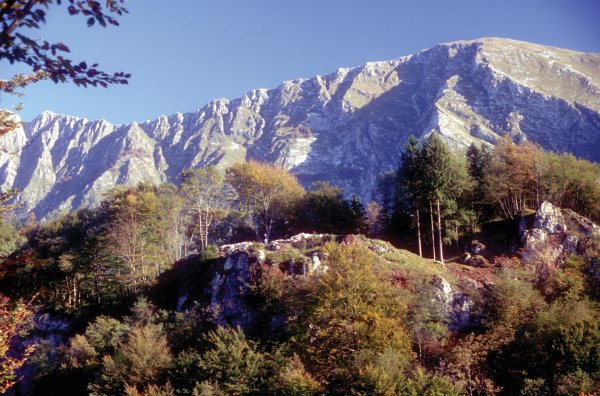
A view of the settlement.
The architectural remains of the earlier phase of the settlement, which
judging from the finds lasted from the end of the 4th and throughout the 5th
centuries, were almost completely destroyed by the construction of later
structures. Small finds (military equipment, transport vessels) substantiate
that this site was a military post in the rear of the Claustra Alpium Iuliarum,
that is, in the defence zone that protected Italy.
The most important period in the history of the settlement of Tonovcov grad
seems to be the last decade of the 5th century. This is when Italy, together
with the present Slovenian territory, was under the rule of Theoderic the Great,
the king of the Ostrogoths. Extensive ruins at the top of the hill dating from
this time reveal dwelling houses and also churches and defence facilities.
The settlement was abandoned towards the end of the 6th century. After this
time some finds point to temporary visits in the Carolingian period.
The location of the settlement, high on a rock formation above the Soča
river, assumed an excellent natural position, favourable microclimatic
conditions and was at the same time not far from the valley and close to an
important Roman road.
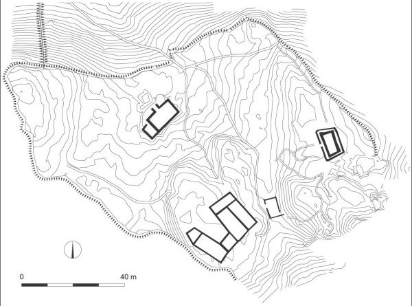
Plan of the settlement
The more exposed parts of the settlement were protected by a defence wall. The
easiest access to the settlement was walled in with a 0.8-meter wide rampart
that was further fortified inside with dwelling houses attached to it.
Perpendicular to these walls, another rampart ran down the steep slope, thus
enclosing a larger area in front of the settlement where refugees could find
some safety when in need. Dwelling houses were concentrated in the front part,
which is endowed with the best natural protection, and above them stands a
smaller rock plateau with the remains of Early Christian churches.
Churches
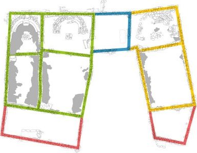 |
Ground plan of the church complex. Colours mark the building phases.
Towards the end of the 5th century and synchronous with the organizing of the
entire settlement, the first two parallel churches were built. A smaller square
room was later added to the south side of one of the churches. Only a tomb cut
in rock was found inside, albeit empty. It is evidently a cenotaph, a symbolic
tomb for somebody who died elsewhere. In addition to the existing two churches,
a third church was later built at the far end of the rock ridge. And in the
final building phase the following structures were added: narthexes (rooms for
teaching non-christened believers) were attached to the three churches, benches
for the clergy with a central seat (kathedra) were built in the presbyteries of
all three churches, and the altars were rebuilt or even erected anew. . |
Plan of the north and central church
A smaller pulpit (ambo) was inside the north church and in the central church
was a simple baptismal font (piscina), which was made by enlarging the existing
crack in the rock basis.
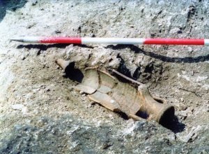 |
An amphora with a Justinian coin by the altar in the central church
A coin of Justinian, found near the altar of the central church, indicates that
the last renovations were made in the mid-6th century, that is, during the time
when the Byzantines conquered the Ostrogoths and annexed this area to the
Byzantine state. In that time the church complex attained its final appearance,
which extended over the entire exposed area of the rock plateau. |
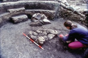 |
Reliquiary
Part of a Roman urn that probably served as a container of a reliquary was found
in the ruins next to the altar in the north church. The reliquiary was made of
precious materials and was taken away by the last inhabitants. |
Structures
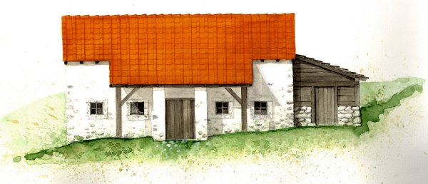
Reconstruction of a house
Towards the end of the 5th or the beginning of the
6th century, a large dwelling house was built in close proximity to the entrance
to the settlement; it was abandoned towards the end of the 6th century. The
house consisted of a solidly built main (dwelling) room to which a smaller
outbuilding of poorer masonry was attached. Each one contained a hearth. The
building was covered with tiles, some window openings were glazed. Entrance to
the main room was sheltered with two perpendicularly attached walls which served
as a windbreak.
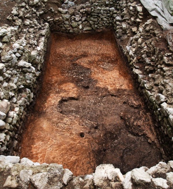
The cistern
A large water reservoir was discovered on the highest, i.e. east plateau. It
was built of a double wall that was connected with a layer of mortar. The inner
wall was coated with a layer of waterproof roughcast, a mixture of mortar and an
abundant amount of crushed brick. The cistern was also encircled with a dry-
mason wall which probably served as a fence.
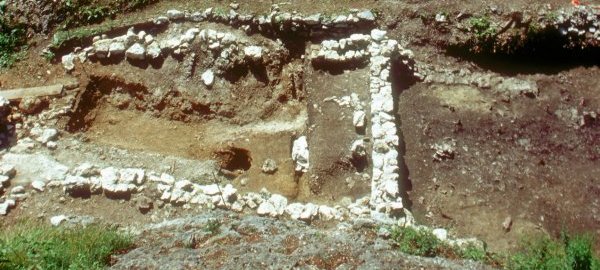
Structures 2 and 3
The structure to the north of the churches had a simple rectangular plan and
comprised of three walls without mortar and a fourth wall with mortar, this wall
being left over from an older building. The remains of a rectangular
construction, which could be interpreted as a small piscine, were found in the
corner of the earlier building. These could be the remains of a simple
baptistery that was added to the church complex at the same time as the third
church.
Finds
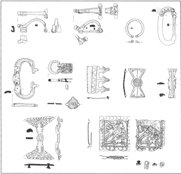
Finds from around the year 400.
Many small finds were found attributed to the Late Roman military costume of
the end of the 4th and beginning of the 5th centuries. Among them are above all
belt mounts and fittings from around the year 400 which were used by soldiers in
forts all over the empire. Quite conspicuous is a bronze belt mount which on
both sides depicts a very rare figural representation of stag-hunting.
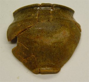
Coarse wares from around the year 400.
Coarse wares from the time between the end of the 4th and the first half of
the 5th centuries still shows the influence of the Roman (imperial) tradition.
Analogies for vessel shapes can be found widely in the south-eastern Alps.
African amphorae, terra sigillata and lamps point to the still strong contacts
with the Mediterranean..
***
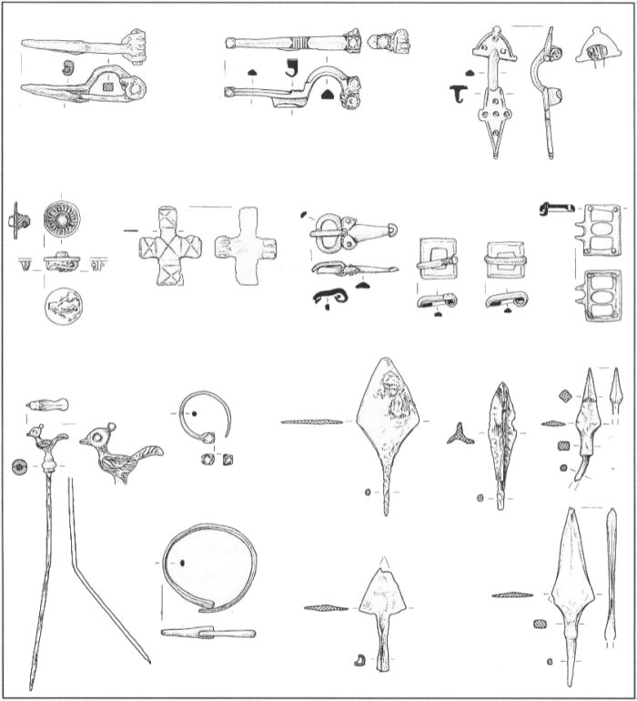
The finds from the 6th century.
The great quantity of excavated material confirms the fact that most of the
inhabitants in the 6th century were Romanized original settlers. A cross-shaped
fibula and a decorative pin with a pigeon suggest the Christian character of the
inhabitants. The Roman component is also represented by numerous bronze and iron
fibulae, ear rings, belt clasps, bracelets and decorative pins..
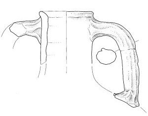
An amphora
The 6th century brings a greater quantity of finds of handmade pottery and
the shapes vary from region to region. Among the imported wares large amphorae
of the eastern Mediterranean are most predominant but small spatheia are also
present.
A Lombard fibula points to the presence of a small Lombard garrison, as was also
established for some other Late Antique settlements (e.g. Rifnik, Vranje, Tinje).
***
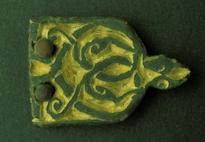 |
Modest remains from the Slavic period point to the last visits to
the hill. The people used the ruins of the antique buildings as
provisional dwellings. The extent of this settlement is not entirely
clear but it is chronologically defined by a beautiful example of a
Carolingian belt fitting from around the year 800 and an Avarian belt
fitting which was probably used in the same period. |
Publications
- CIGLENEČKI, S. 1994, Scavi nell'abitato tardo-antico di Tonovcov grad presso Caporetto (Kobarid) Slovenia. Rapporto preliminare. - Aquil. Nos. 65, 186-207.
- CIGLENEČKI, S. 1997, Tonovcov grad pri Kobaridu. Arheološko najdišča. Vodnik - Ljubljana - Kobarid.
- CIGLENEČKI, S. 1997a, Poznoantični in slovanski sledovi na Kobariškem. - In: Kobarid. Kobarid, 17-28.
- CIGLENEČKI, S. 2000a, Poznoantično Posočje in problemi langobardske obrambe Italije. Goriš. letn., 2001, št. 27, 51-66.
- CIGLENEČKI, S. 2001, Romani e langobardi in Slovenia nel VI secolo. In: Paolo Diacono e il Friuli altomedievale (secc. VI-X). 1a ed. Spoleto: Centro italiano di studi sull'alto medioevo, 2001, 179-200.
- CIGLENEČKI, S. 2005, L'insediamento fortificato su altura di Tonovcov grad presso Caporetto e i suoi ditorni in eta romana e paleo-slava, La cristianizzazione degli Slavi nell'arco Alpino orientale, A. Tilatti (ed), Instituto di storia sociale e religiosa.
- MODRIJAN, Z. 2005, L'edificio 1 dell'insediamento tardoantico di Tonovcov grad presso Kobarid e i suoi reperti. - Quaderni Friuliani di Archeologia 25, 2005, str. 157-162.
- MODRIJAN, Z. 2005, Oskrba z vodo v poznoantični utrjeni naselbini Tonovcov grad pri Kobaridu = Water supply to the late antique fortified settlement of Tonovcov grad near Kobarid. - V: Mihevc, Andrej (ur.). Kras : voda in življenje v kamniti pokrajini = water and life in a rocky landscape, (Projekt Aquadapt). Ljubljana: Založba ZRC, ZRC SAZU, 249-264.
- MODRIJAN Z., T. MILAVEC, L'insediamento tardoantico di Tonovcov grad alla luce dei reperti ceramici e metallici. - Forum Iulii , Udine (v tisku).
Contact:
<< Programme: Roman Period | << Programme: Late Antiquity
Top
|
 Institute of Archaeology


